
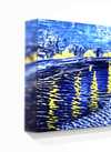
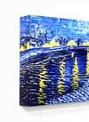
Ръчно рисувана маслена картина върху платно във вашия размер и рамка, изработена по поръчка от нашите художници. (![]() Купете принт
Купете принт![]() Купете изображение)
Купете изображение)
Изберете от предварително зададените размери, които съответстват на оригиналните пропорции на произведението.
Можете да въведете свои собствени размери, за да пасне на конкретна рамка или пространство. Ако избраният от вас размер не съответства на пропорциите на оригиналното изображение, ние ще изрежем произведението или ще удължим картината с допълнителни ръчно рисувани елементи. Дигитален макет ще бъде изпратен за ваше одобрение преди започване на производството.
Моля, обърнете внимание, че прегледът на екрана не отразява действителното изрязване или разширяване. Само макетът ще покаже точно финалния състав.
Въпреки че са налични персонализирани размери, препоръчваме да изберете размер от предварително дефинирания списък, за да запазите оригиналните пропорции.
Доставка по целия свят () в рамките на 3/4 седмици вместо стандартните 5 седмици. (23 Август). Без компромис с качеството.


Guadeloupe
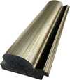
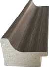
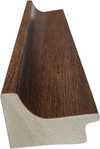
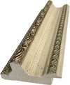
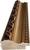
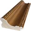
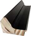
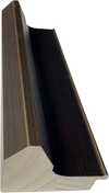
Размер на репродукцията

1719 - 1771


Бъдете информирани за последните новини в света на изкуството, ексклузивни оферти и идеи за декорация.
Разкажете ни за вашия проект и нашите експерти по изкуство ще ви предложат 3 персонализирани предложения за произведения на изкуството.
Нека подберем 3 варианта само за вас – безплатно!
 Изпрати
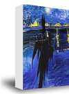
 Стъклото е налично само в размери под 110 см


